Juan and I had just finished up a long weekend of amazing backpacking when he asked the obvious next question: “So, what are we doing for the next long weekend?”
The Lost Creek Loop, our latest adventure, had been on the bucket list since passing through the area while hiking west on the Colorado Trail. It commonly tops all the listicles of best backpacking routes in Colorado, and for good reason – the scenery was amazing, and the logistics were simple.
One of the reasons that I loved Lost Park at first sight was that I was surprised by it. My entire Colorado Trail experience was one amazing surprise after the next, as someone who had moved to the state less than a year before. For our return trip, I had been reading trip reports and looking at pictures for the better part of the year, excited to finally get back to explore. While Lost Park and the Tarryall Mountains did not disappoint in the slightest, I wanted a different kind of trip for our next trek.
Trek Planning
For this trip, I wanted an area that would not be overwhelmed with hikers or car campers on the Fourth of July weekend. I chose the Rawah Wilderness Area, a stretch of the Medicine Bow Mountains just south of the Wyoming border. I hoped the nearby Rocky Mountain National Park and Indian Peaks Wilderness Area would attract most of the people.
I also wanted to try a new style of trek planning. My previous backpacking experience had relied on guidebooks and apps like FarOut and AllTrails. These work well for popular routes, but I was specifically looking to get away from the crowds. I decided this was a perfect opportunity to put to use my new Gaia GPS skills learned from the BPL Masterclass and design a route myself.
After adding trailheads, points of interest, and major trail corridors to the map, I drew four route options that connected or passed nearby the sites I was most interested in. I then downloaded the map of the area to my phone, and left the remaining decisions for us on the trail.
Day 1
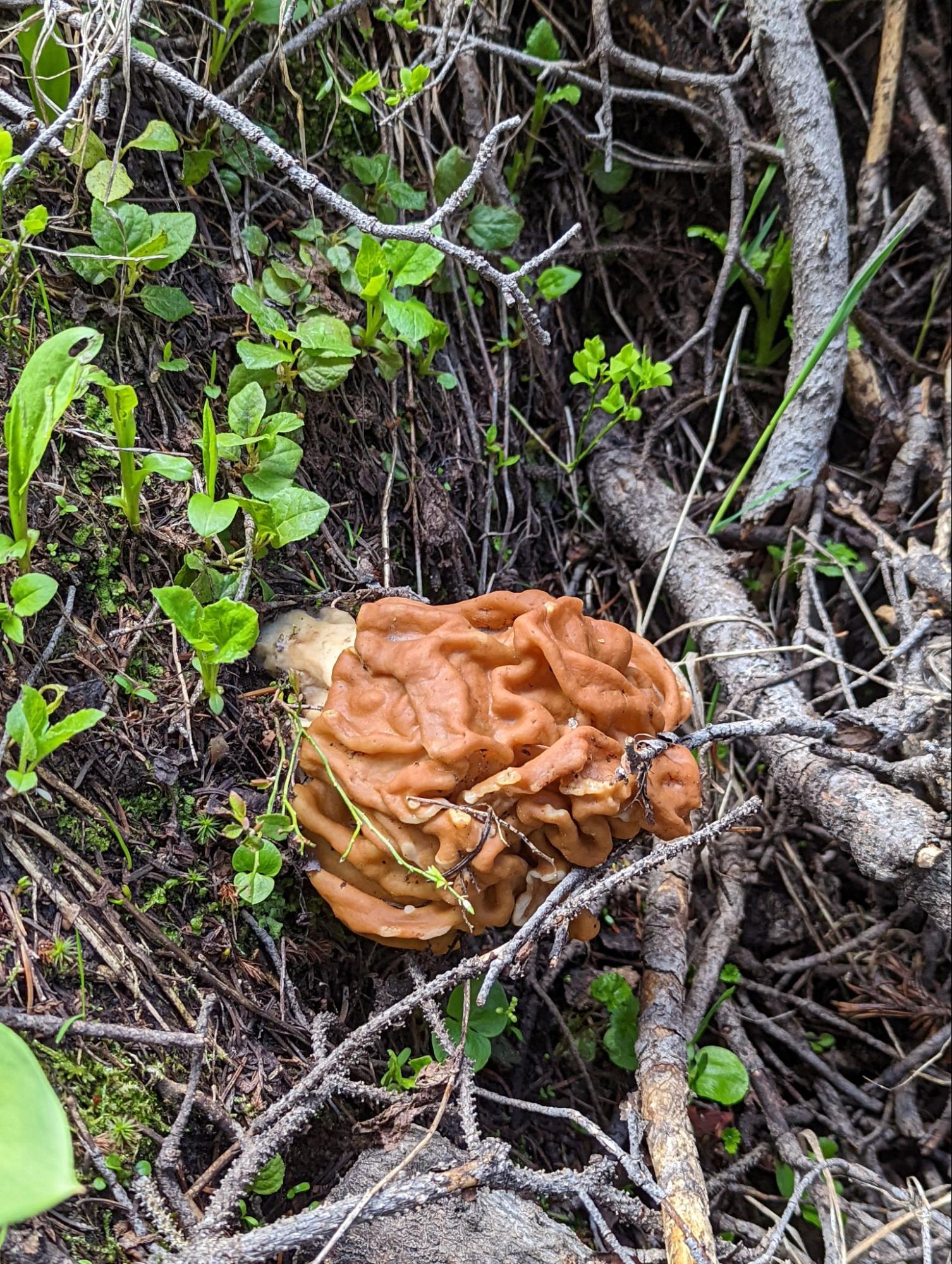
We spotted over one hundred pronghorn on our way to the trailhead, along with dozens of voles that kept dashing in front of our wheels. The flexibility built into our trip plans immediately paid off, as Juan slept through his alarm and was a couple of hours late to our meeting place. We killed time by hiking around the trailhead looking for mushrooms, as my wife Liz had recently become an amateur mycologist. When he finally arrived, we left his car there at the end point of our hike and shuttled to our stepping off point.
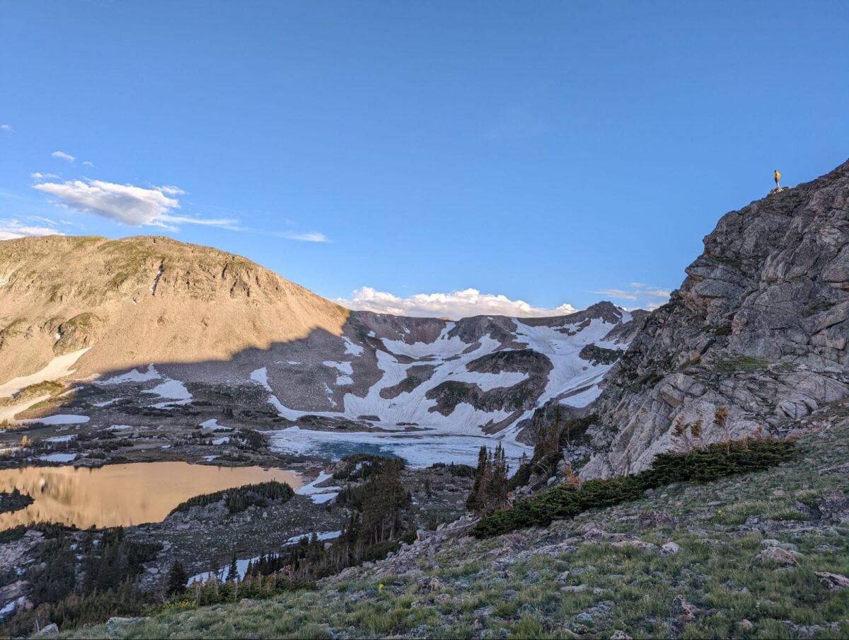
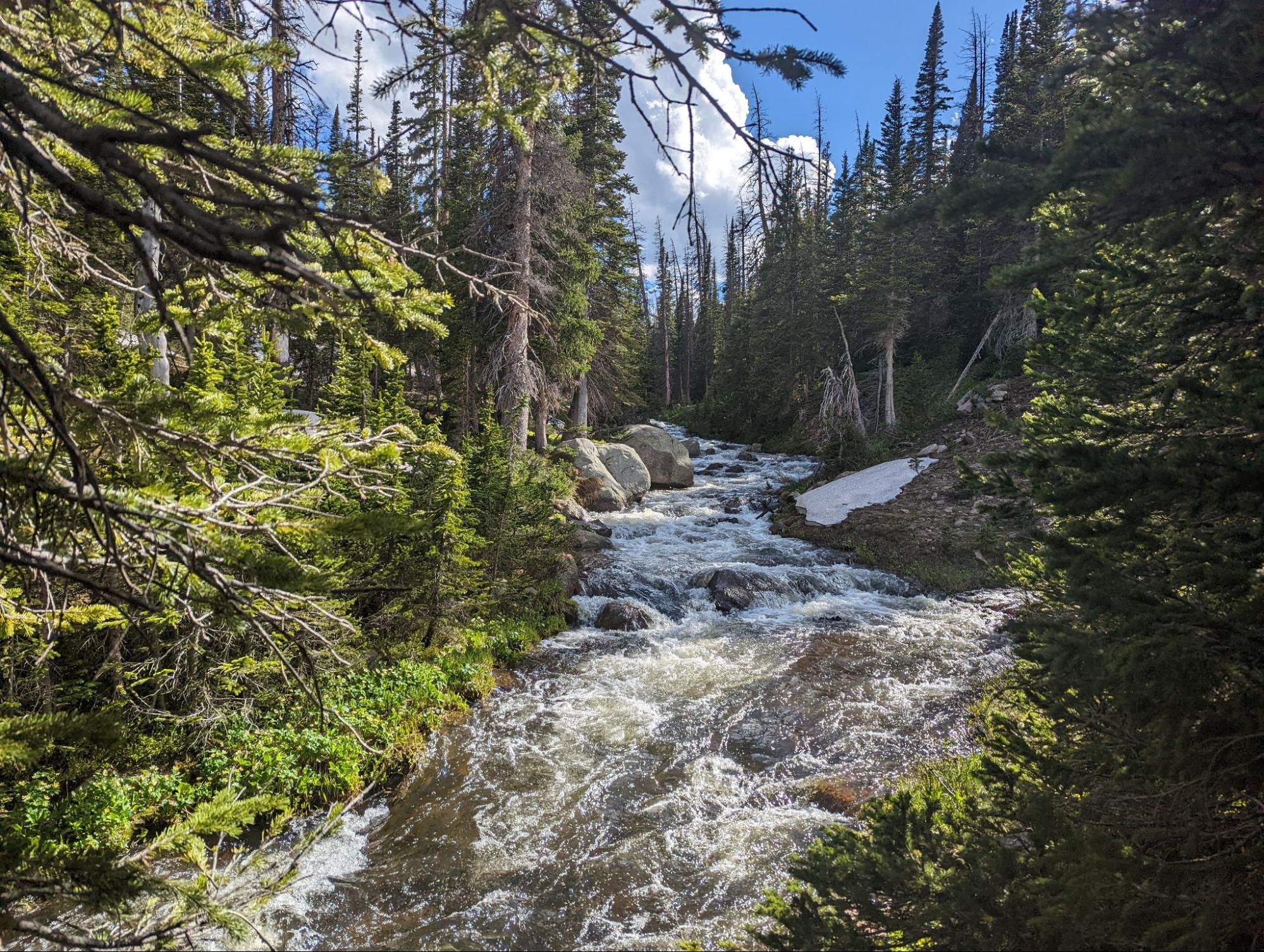
Our first goal was an unnamed waterfall just over two miles from the trailhead. My dog, Socks, was thrilled to be hiking, and expressed his displeasure whenever we stopped to admire a view or catch our breath with an escalating series of low growls to sharp barks. The ground was often soggy or submerged- a portent of things to come- and the creek was fast and often overflowing its banks. Soon we heard the thunder of the falls, and our view kept improving as we climbed and saw more tiers of the waterfall.
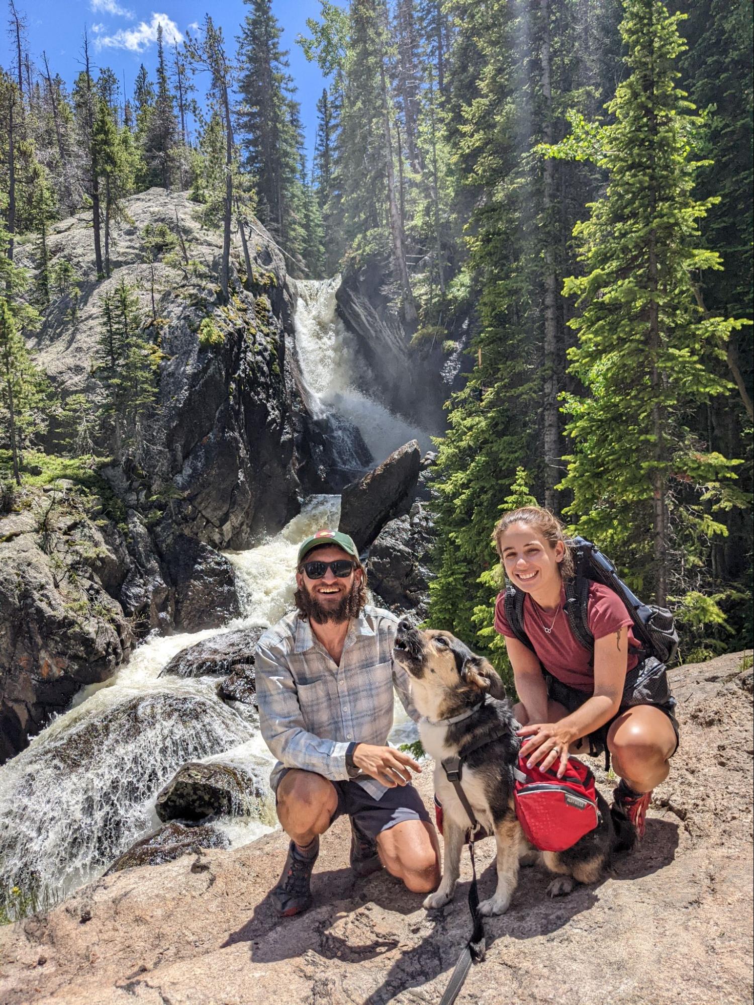
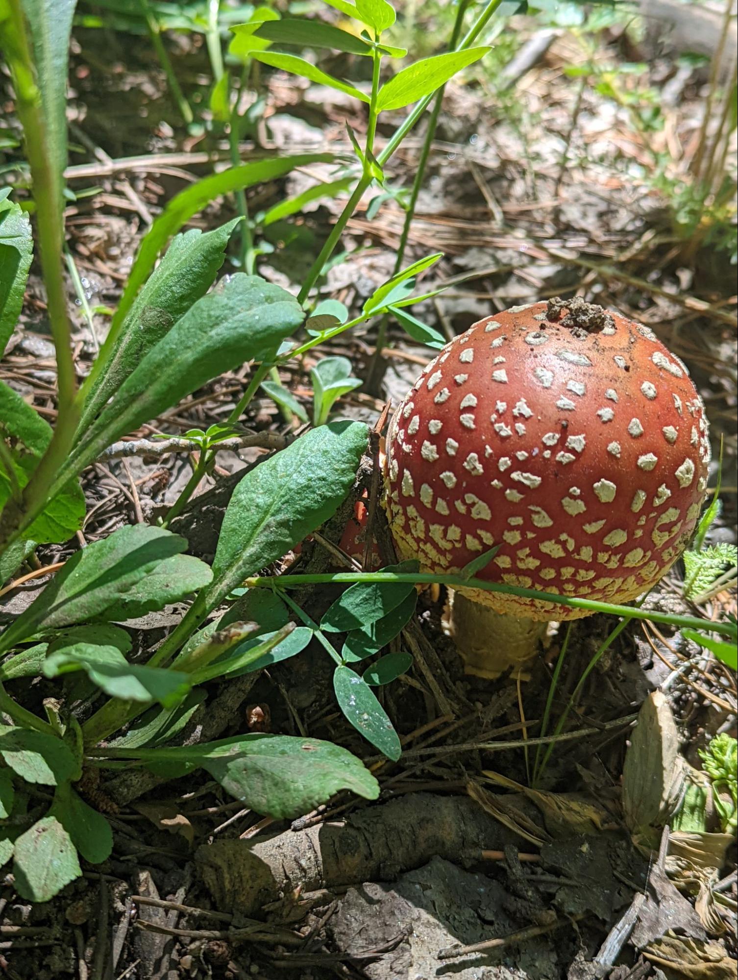
Liz and Socks split off to head back to the car, while Juan and I continued towards our campsite for the night. No sooner had they left than it seemed the ground exploded with mushrooms. A few steps off the trail to get a closer look at a mushroom visible from the trail often revealed dozens of species within a few feet. I took pictures for Liz, noting the context and specifics necessary for identification, such as the elevation and nearby tree species.
We aimed for a subalpine lake with a surrounding meadow for our campsite, but first had to ford the creek. After searching up and downstream for an easy way across and finding none, we grit our teeth and stepped into the icy waters.
We arrived at the lake to find it all to ourselves and the mosquitos. The “meadow” was in fact a combination of dense willows and waterlogged or submerged moss, but we happily watched the sun set over the lake and found a campsite just inside the tree line. We made a small fire and planned the next day’s adventure.
Member Exclusive
A Premium or Unlimited Membership* is required to view the rest of this article.
* A Basic Membership is required to view Member Q&A events

Home › Forums › The Gift of Surprise in the Rawah Wilderness